
East Carolina University Operation FORAGER

Photogrammetry: Making 3D Models of WWII Sites
By Allyson Ropp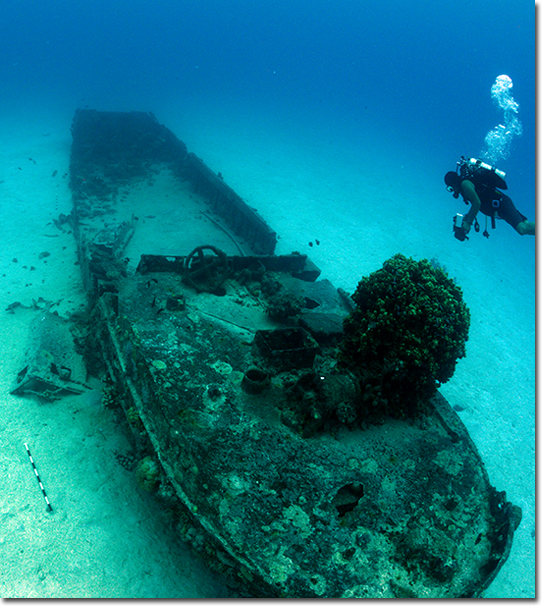
Dr. Kota Yamafune captures a Daihatsu (photo by W. Hoffman).
Welcome to the world of hi-tech archaeology! We are using photogrammetry, or the science of taking measurements from photographs, to record sites on the heritage trail as well as "control" sites to look at degradation over time. Typically, photogrammetry results in 3D models but can also be rendered into a two-dimensional site plan. Our photogrammetric surveys will result in 3D models and plans for those areas that do not have completed site plans.
Our photogrammetry expert, Dr. Kotaro Yamafune, is overseeing producing and post-processing hundreds of photographs from each of the sites to create these 3D models. The process begins with the equipment: a camera, a tile, and some scale bars. Very simple equipment, but what results is amazing.
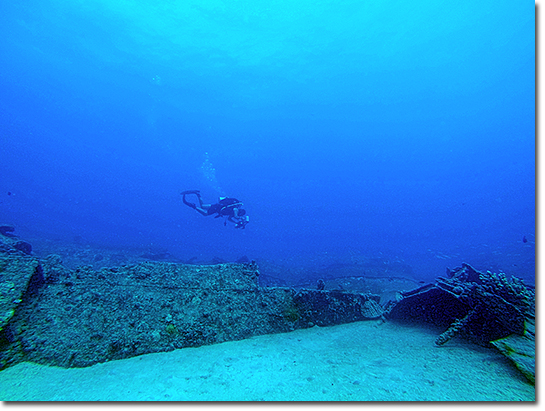
Dr. Kota Yamafune capturing the Sub Chaser (photo by A. Ropp).
Next, it's time to dive! Scale bars are laid out around the site so as to bracket the site and create a boundary within which to photograph. These scale bars also provide a way to measure the size of the site and associated artifacts and are useful for post-processing the data in the software. After the scale bars are placed around the site, the camera must be set and white balanced, a form of color correction that is an adjustment that renders colors correctly. Kota uses a large white tile to white balance his camera.
Following the white balancing, the photographing can begin. Kota first swims a square around the site enclosing the site and ensuring all scale bars are included. Next, he swims transversely across the site clicking away, capturing every piece of information that the site holds. Then, he swims longitudinally across the site covering the same area from a different angle. Finally, he captures vertical sides of the site if it is sitting proud of the seabed. This entire process requires him to go back and forth, back and forth, back and forth, and on and on and on until he has finished the process.
With all the data collected from the dive (or dives, since sometimes the sites are too big to be photographed in one dive), the hundreds of photo files are downloaded on to the computer and loaded into Agisoft PhotoScan software. Once in the software, the photo files are aligned and assembled into a point cloud (a three dimensional arrangment of points). A mesh is then added to create the relative shape of the site. Finally, texture is added to the mesh to make the final model. This model is created to scale and color corrected to look almost identical to the actual site.
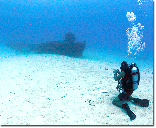
Dr. Kota Yamafune white balancing his camera (photo by W. Hoffman).
Photogrammetry offers multiple different uses for archaeologists, including our team in Saipan. It can provide information about site changes over time, as we are using it. As such, the models created on this trip will be compared to previous photographs and site plans to see how the sites have been impacted by divers or even recent storms, such as super typhoon Soudelor in 2015. The method also offers rapid documentation of a site and can supplement traditional recording methods in creating site plans and measuring data. Most importantly, photogrammetry offers an amazing outreach tool. 3D models can be printed and turned into tangible items for all to see and touch. The models can also be loaded on to touch screens and computers which can be explored by individuals at their leisure. Particularly for maritime archaeologists, this method provides a chance to showcase sites not accessible to everyone, unless you are a diver. It brings the heritage to the public in a new technology-driven way!
Here is one example of our digital 3D models.
To see more of our models of the various WWII Underwater Maritime Heritage Trail Sites available online please check out the Sketchfab site here.
Previous Next