Van Don Project Page
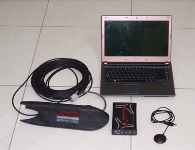
Starfish 450F System with towed sensor ("fish"), laptop computer, top box and GPS sensor (photo by John Pollack, courtesy of the Bach Dang River and Van Don Research Team).
The 2012 field season
In 2012 the research team conducted a side scan sonar survey of part of the channel to the west of Quan Lan Island, Vietnam. Our goal was to assess an area reputed to be the location of the 1288 A.D. battle where Vietnamese forces destroyed a fleet of Mongol supply ships. Only part of the area could be surveyed in the short time available and approximately 25 linear kilometres of side scan data were collected in two days using a Starfish 450F side scan sonar shown in the photo above.
The 2012 team of researchers also drilled down into the mud of what are now rice paddies on Quan Lan Island and retrieved a core. The core sediments were deposited year after year and will be analyzed for evidence of past plant life, including pollen and wood/leaf fragments, landscape processes such as fire, using charcoal fragments, and deposits related to floods or storm events. The data will also be useful in determining impacts of climate change on the ecosystem of northern Vietnam and human-related landscape changes that happened over the last 4000 years. Additional coring is planned over the next few years on both the mainland and nearby islands in order to reconstruct a broad picture of environmental change.
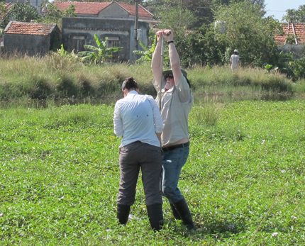
Dr Christy Briles and Dr Mark Staniforth using the "Livingstone" corer on Quan Lan island during the 2012 season (photo by Dr Le Thi Lien courtesy of the Bach Dang River and Van Don Research Team).
Next