Nhge An Project Page
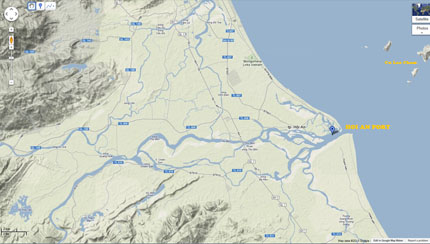
Map of The Port of Campa / Hội An (Map by Do Truong Giang). View larger version here.
The Port of Campa / Hội An
The Port of Campa (Chiêmcảng/占城口) and known as Hội An/會安/ Faifo City-Port from the Sixteenth century onward, is a principal port on the coast of Campa from at least seventh century CE to roughly 12th century CE. This port is located in the basin of the Thu Bon River (in present day Quang Nam province). Thanks to its strategic location and the richness of trading commodities in Nagara Amaravati, the Port of Campa, along with the Cu Lao Cham Island (Pulao Cam) offshore from the Thu Bon River, enjoyed prosperity for centuries.
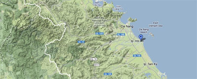
Location of the Port of Campa and Cu Lao Cham Island (Map by Do Truong Giang). View larger version here.
Previous Next